Posts Tagged ‘maps’

Mapping the Georgian World: video now available!

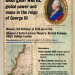
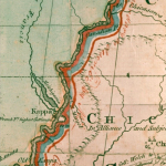
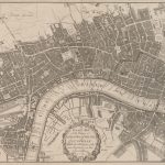
We are delighted to announce that you can now watch a video-recording of the richly-illustrated event on ‘Mapping the Georgian World – Maps and Power in the reign of George III’ which was delivered to an enthusiastic audience at the 2017 Arts and Humanities Festival at King’s College London on 9 October 2017. The main… Read More »

Mapping the Georgian world: Panel Discussion, 9 Oct

The Georgian Papers Programme is pleased to invite you to: Mapping the Georgian world: global power & maps in the reign of George III Monday 9th October at 6:30-8:00pm Edmund J Safra Lecture Theatre, Strand Campus, King’s College London Free admission to all, but registration required via Eventbrite  The Hanoverian British monarchy presided over a… Read More »

Picturing Places at The British Library: Georgian Places

The British Library has announced the launch of Picturing Places, a new free online resource which explores the Library’s extensive holdings of landscape imagery. Picturing Places will help researchers interested in the Georgian period to visualise the eighteenth century more clearly. One of the leads on the project, Felicity Myrone at the British Library, was… Read More »